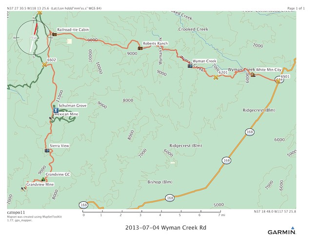
For July 4th we decided to get off the hot desert floor and go visit the much cooler Bristlecone Pine forest. Yes you can get there on pavement, but what is the fun in that?
This route is from Rodger Mitchell’s Inyo-Mono SUV Trails
Here is another great trip report of the area from 4wdtrips

From Desert Fever: An Overview of Mining in the California Desert Conservation Area by Shumway, Vredenburgh, Hartiil
WHITE MOUNTAIN CITY
A year after the discoveries at Coso (1861), J. S. Broder, Col. L. F. Cralley, the Graves brothers and Dan Wyman (all miners from Aurora, Nevada) came to the east side of the White Mountains seeking placer gold values said to exist there. By 1864 White Mountain City and Roachville (on Cottonwood Creek) both had regularly surveyed town plats. By 1881, the Tarrytown District was located on a mineral belt 6 miles long and 2 miles wide that was 6 miles west of Deep Springs Valley. It was both a silver and gold district. Ore values ran from $75 to $150 per ton. The principal mines of the Tarrytown District were the Heritage, which boasted a 3 1/2 foot wide vein that averaged $124 in silver and $15 in gold per ton, and the Alta, which had a 2 1/2 foot wide vein and 80 tons of ore on it’s dump.
At least 8 mines, among them the California, Indian, Greenly and Cairo, were listed as being in the Deep Springs area. Although it was said that “the development on these claims has been sufficient to show that they will become permanent mines” not much is known about them. It is presumed that they became unprofitable, due to the drop in the price of silver, by 1893.
Although little is known about White Mountain City and Roachville, they most likely served as supply centers for prospectors exploring these gold-silver mines and for those working in the White Mountains gold region in southeastern Mono County. As late as 1918 the area experienced some activity with D. F. Shively filing 11 tungsten claims on the north edge of Deep Springs Valley to develop a series of parallel quartz veins in granite up to 4 feet in thickness.

The meager remains of White Mountain City rise above the snaky desert shrubs
A history of the area from GhostTowns.com

The Hiskey & Walker smelter stack, which postdates White Mountain City, overlooks Wyman Creek
Once a good living space, always a good living space. The Piaute used this area and it’s resources long before the miners moved in.
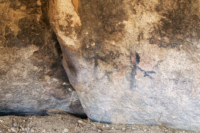
Anthropomorphic rock art is rare in this region; pictographs are even rarer

Wyman Creek Road exits the channel of Wyman Creek as it begins its ascent of the White Mountains

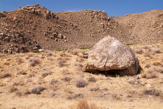
The initial ascent of Wyman Creek Road winds through monzogranite boulder piles reminiscent of Joshua Tree National Park

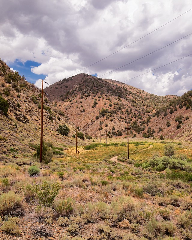
Wyman Creek Road reenters the channel of Wyman Creek after the boulder piles

Located halfway between White Mountain City and Schulman Grove in the Bristlecone Pine Forest, Roberts Ranch is a perfect place to stop for lunch.

This supposed smelter stack is original to Roberts Ranch

The cabin next to the smelter stack is built upon the stone foundation of a much earlier structure
One can drive from Roberts Ranch to Schulman Grove in any high-clearance vehicle

This cabin made of railroad ties is the final landmark along Wyman Creek Road before it ends at Silver Canyon Road

This Worthington engine is the last significant artifact at the Grandview Mine
Mine Dat page

Jenni at the Grandview Mine, which is located about a mile beyond its namesake campground

Using the last light of the day to look at the view of the Sierra Nevada from the Grandview Mine

Last light on an ore chute, the last structure at the Grandview Mine

It was 4th of July weekend, the Grendview Campground was full. Luckily on the road to the Grandview Mine there are a few Jeep-in camp sites.


